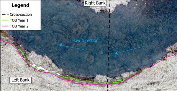
Figure 6. TOB surveys in ArcGIS.
Schematic showing how top of bank survey is done in ArcGIS. Right bank at top, left bank at bottom. Streamflow direction right to left. Dashed line shows cross section location.